(led by Mária Šibíková and Ivan Jarolímek)
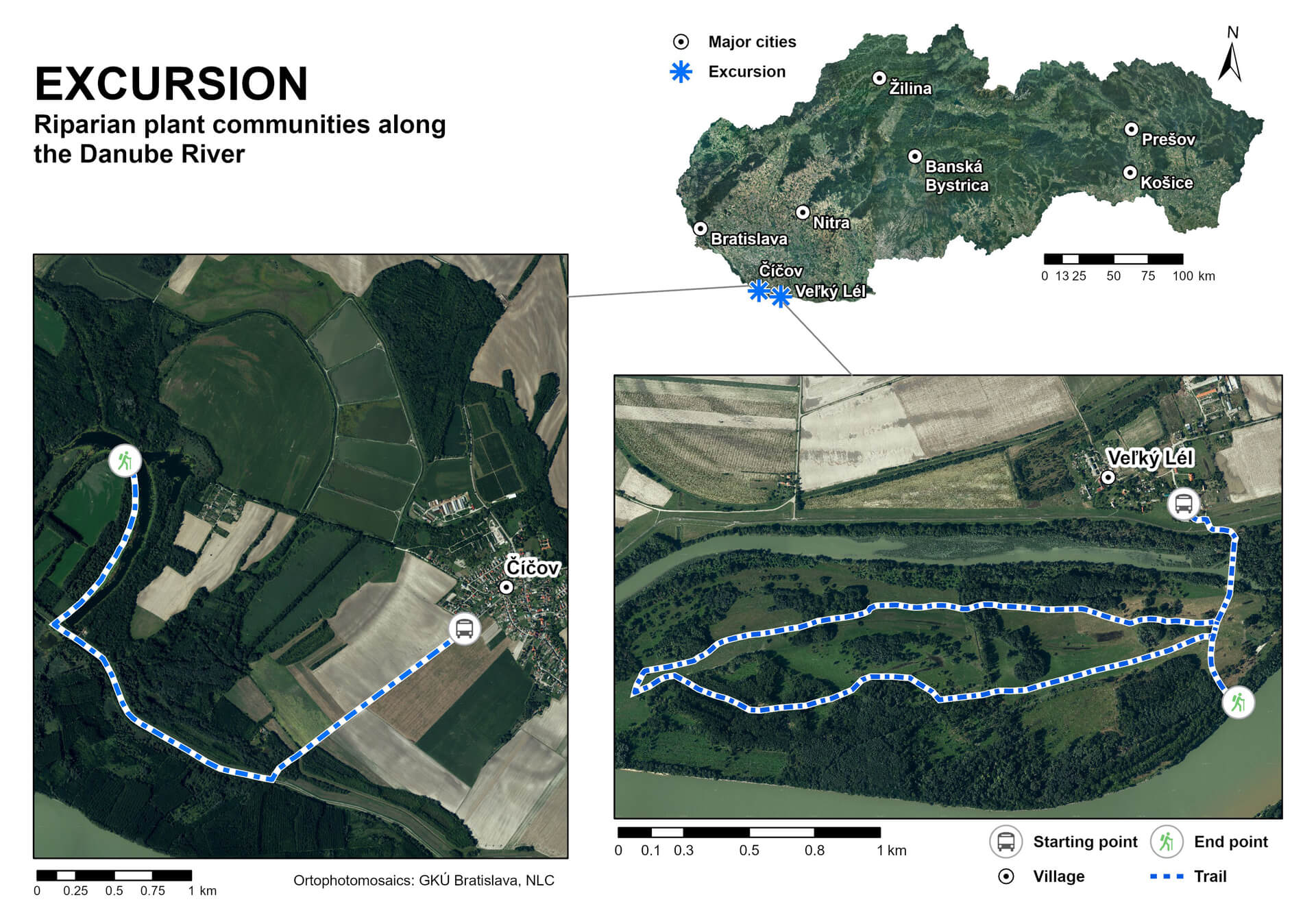
The excursion will take place in a part of the geomorphological unit Podunajská nížina lowland, where the main landscape-forming factor was the Danube River that changed its course regularly in the past. Rapid rates of lateral erosion at the one side and the creation of extensive deposits of gravel and sand, on the other hand, contributed to the constantly changing landscape. The network of river branches formed the Danube inland delta.
A considerable part of the inland delta was covered by floodplain forests in the neolithic era before humans settled the territory (Krippel 1986, Michalko 1987). The hardwood floodplain forests were situated in higher positions on older river terraces affected by groundwater table fluctuations and, irregularly, by short-term flooding. Willow-poplar softwood floodplain forests covered lower terraces with regular floods. The Danube River formed large and dynamic branch systems until the need for river transport resulted in the regulation of the branch system into one large riverbed. The decreased groundwater table in the remaining branch system encouraged agriculture in the regulated area. In addition, the vegetation cover changed considerably due to deforestation and fragmentation of the area (Generel 1976). The main intervention in the floodplain forests during the last few decades has been the Gabčíkovo Dam construction, joining the Hrušovská zdrž water reservoir constructed between 1977 and 1992.
Two different localities will be visited during the excursion. The first one, Číčovské mŕtve rameno Nature Reserve, represents one of the largest river oxbows in the Slovak part of the Danube catchment as well as one of the last places within inland delta with preserved natural character. The second locality, Veľkolélsky ostrov Island, was affected by human impacts in the same way as the rest of the inland delta area, but from 2006 several Life projects were implemented in the area, and recently it is a great example of successful revitalization of Natura 2000 habitats and traditional land use.
1. Číčovské mŕtve rameno Nature Reserve
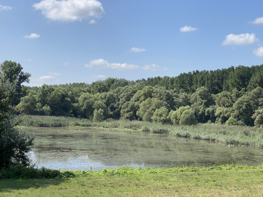
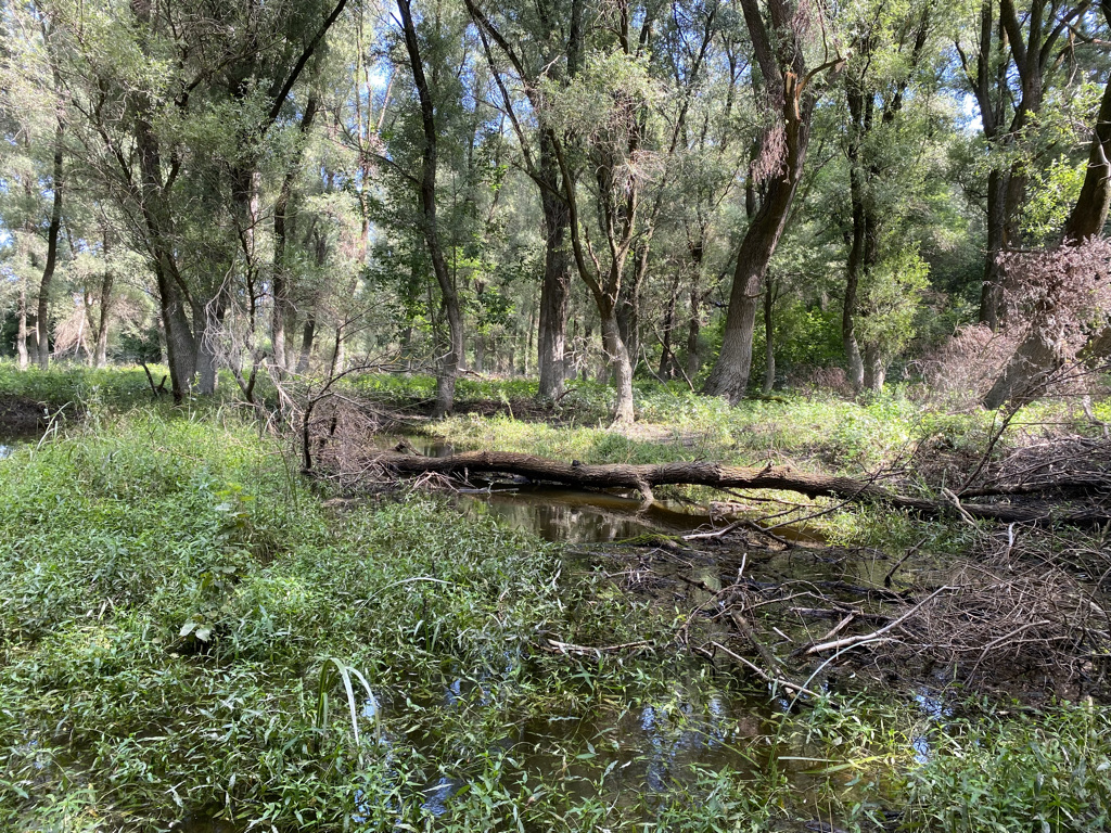
Nature Reserve Číčovské mŕtve rameno is part of this area, and it was the Danube riverbed in the past, which turned into a large oxbow lake, the last preserved representative of this type in the Slovak section of the Danube. Until the early 20th century, adjacent part of river oxbow was covered by a mosaic of meadows, pastures, and flood-plain forests. Recently, the site represents a well-developed mosaic of different habitats with domination of aquatic vegetation (3150 Natural eutrophic lakes with Magnopotamion or Hydrocharition–type vegetation). Littoral zone is created by marshy plants followed by willow shrubs along hydrological gradient. Forest habitats are formed by hardwood floodplain forests, habitat type 91F0 Riparian mixed forests of Quercus robur, Ulmus laevis and Ulmus minor, Fraxinus excelsior or Fraxinus angustifolia, and 91E0 Alluvial forests (Salicion albae). An extensive remnant of a much older riverbed of the Danube is present at the north-eastern border of the site. This large shallow depression is covered mainly by reed beds and wet meadows. The flora of area contains 341 vascular plant species, including rare ones, e.g. Cirsium brachycephalum, Hottonia palustris, Leucojum aestivum, Lycopus exaltatus, Najas minor, Nuphar lutea, Nymphaea alba, Nymphoides peltata, Salvinia natans, Thalictrum flavum, Trapa natans, Utricularia vulgaris, etc.
This site is the lowermost part of the huge branch system of the Danube inland delta. The dynamic of this part was not so high compared to the upstream parts of the inland delta, and the river tended to concentrate within one main channel. At the beginning of the 20th century, the main channel was rebuilt into a straighter form. This site wasn’t influenced by the Gabčíkovo water dam construction. Since Nagymarosi part of the dam system wasn’t built, this area remains unaffected, and the water regime didn‘t change so much.
2. Veľkolélsky ostrov Island
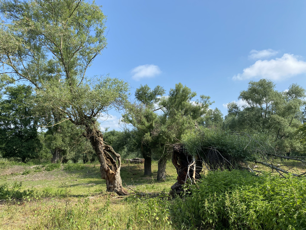
The second excursion site covers one of the biggest Danube islands in Slovak Republic – Veľkolélsky ostrov Island. The gravel-sand deposits form the geological basement of the area. The site represents unique mosaic of forests, meadows and water habitats and that in combination with low human disturbances provide favourable conditions for high biodiversity of the area. The island is regularly flooded during higher water levels of the Danube River. „Veľkolélske rameno“ river branch that surrounds the island is one of the broadest river branches in the Slovak part of the Danube. It is an important breeding habitat for many fish species and feeding habitat for birds.
In the past, this huge island was accessible only by fording place, so it was an ideal place for the grazing of farm animals. The surrounding country was used as agricultural land. Veľkolélske rameno river branch was connected with the Danube until regulation after 1980. After the abandonment of grazing, wet meadows were affected by invasive species spreading, and natural forests were replaced by poplar plantations.
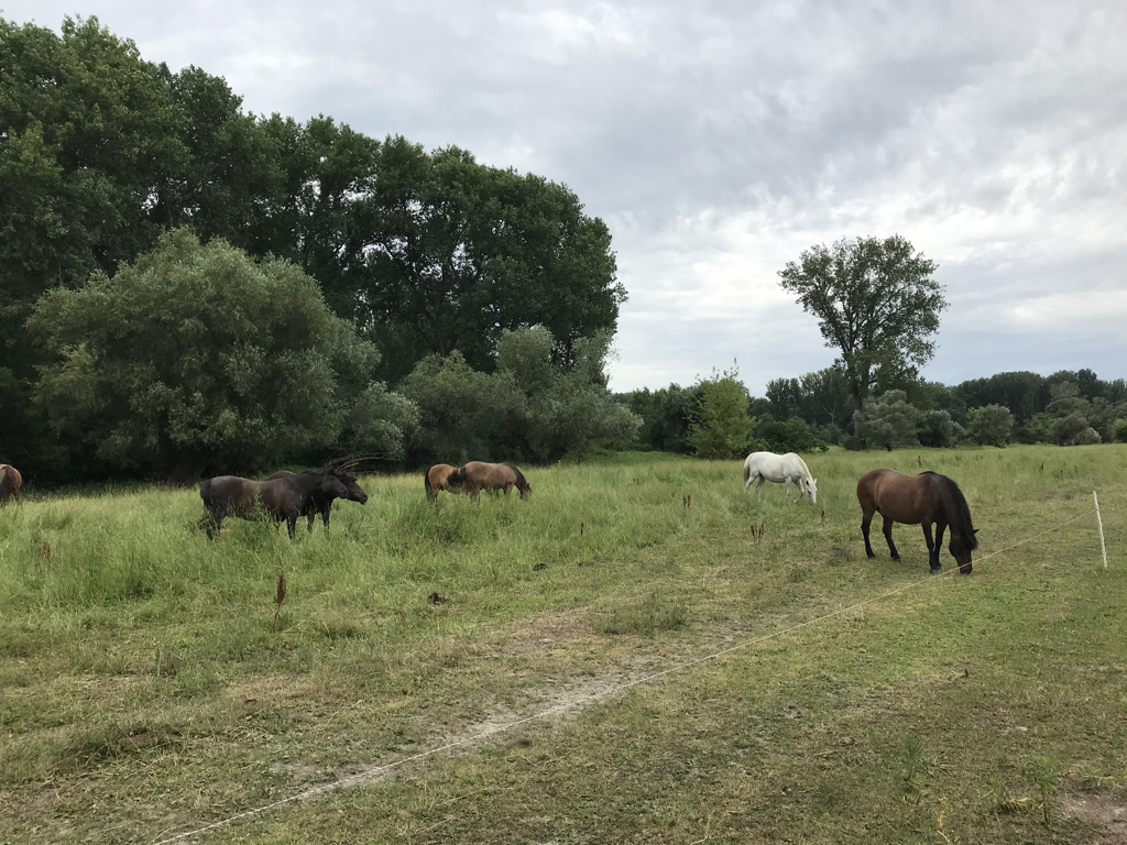
In 2004 – 2005 the island became a part of the Special Protected Area SKCHVU007 Dunajské luhy and so it was included in the European network of protected areas Natura 2000. The island is also an independent Special Area of Conservation SKUEV0183 Veľkolélsky ostrov covering 328,65 hectares. After 2006 many conservation and management activities led by BROZ (Bratislava Regional Center for Nature Conservation) were implemented in this area, including reconnection of the river branch with the main Danube stream. Other management actions were replacement of plantations by native trees seedlings and renewal of traditional land use. Nowadays the site is used once again as extensive pasture for cattle and horses. Pollard willows are present in high numbers and are traditionally coppiced and used for firewood.
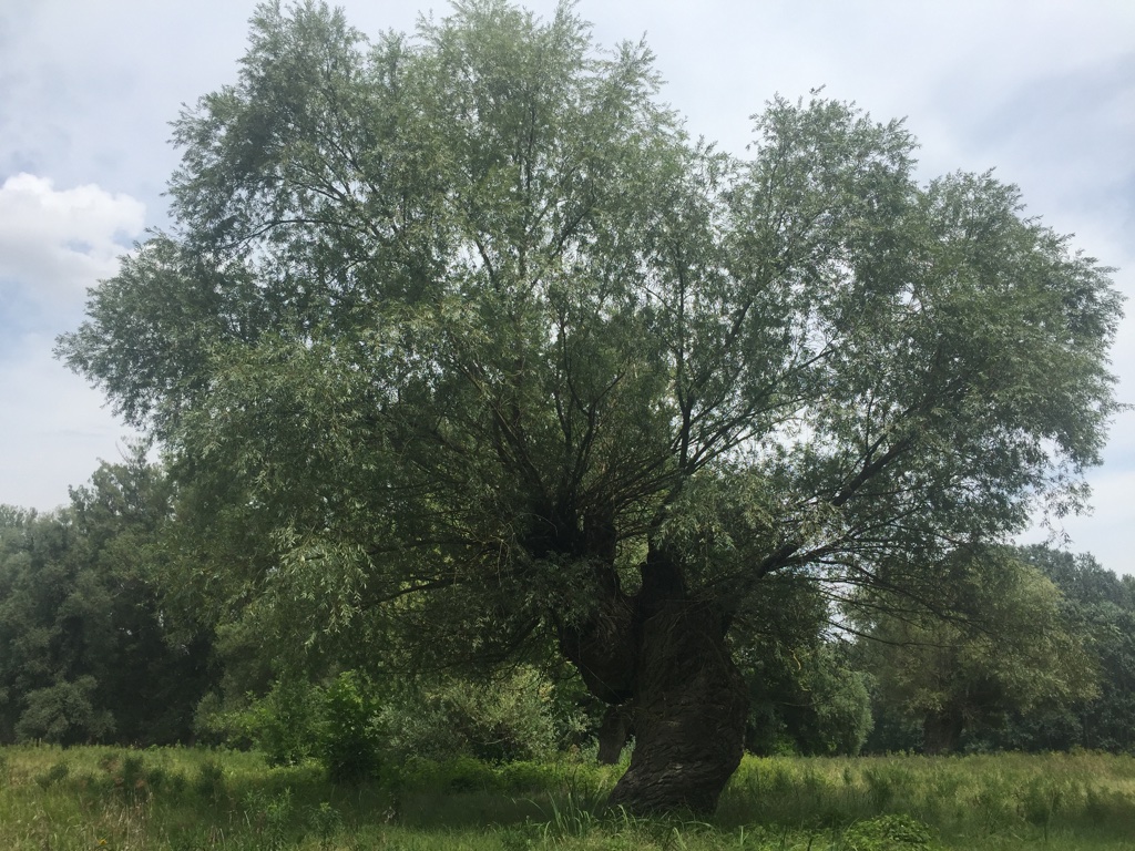
Recently, vegetation is represented by softwood and transitional floodplain forests (91E0 Alluvial forests of Salicion albae) with great number of old tree individuals in some cases more than 400 years old. Most preserved part of the floodplain forest was designated as Nature Reserve Zlatniansky luh. Alluvial meadows (Alopecurion) influenced by regular flooding of Danube are important habitats for many species of pannonic flora.